Owego To Ithaca...
Exploring History
Online research of historical topo maps as well as zooming in on aerial views gave me a rich array of possibilities to locate old RR ROWs in the vicinity but in lieu of my limited time in the area I was only able to photograph a couple of spots. My main focus was the abandoned railroad ROWs connecting Owego to Ithaca.
Railroad Remnants Between Owego and Ithaca
Note: By visiting Acme Mapper, you can follow along with either street, satellite or topo views.
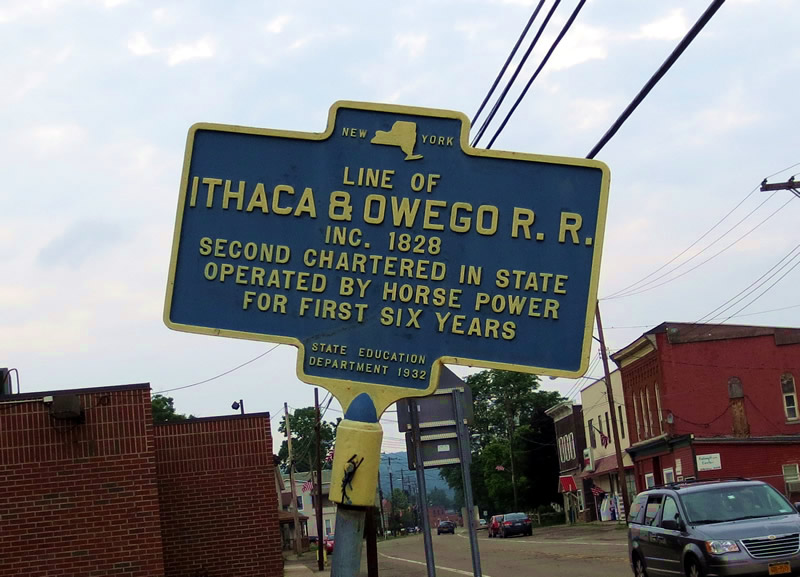
- Candor -
The bridge abutments in Candor are still visible as well as an historical sign about the railroad history. Right near where I parked, I noticed an interesting Barn structure near the abutments (Which I failed to photograph !... ). It turns out it was once a coal storage site.

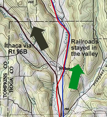
- The Valley -
As one drives north on Rt 96 / Rt 96B, one can clearly see why the RRs veered northward toward Brooktondale rather than following a more direct route towards Ithaca that 96B takes. Straight north continues thru the valley, the northwesterly 96B route starts to climb.
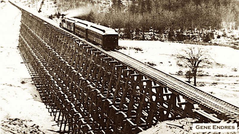
- Remembering the Trestle -
On my return south from the East Ithaca Trail, I opted to drive back thru Brooktondale and turn south to reach Coddington Road, all the while visualizing in my mind’s eye what the area must have been like 100+ years ago. Brooktondale/Caroline for example was renown for its huge trestle. The wooden trestle built in 1874 over Six Mile Creek was 1,600 ft long and 90-ft-high! It was rebuilt in steel in 1894. More info and photos >
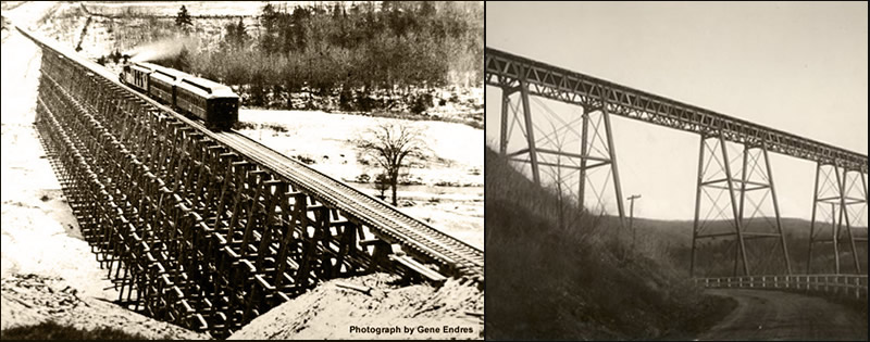
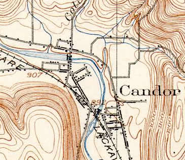
As you can see from a more recent topographic view, the southside embankment for the trestle is on the map. As this great site reveals, traces of the old track bed can still be seen just north of where the trestle was. Regretfully, I didn’t stop to try and sniff it out.
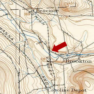
- The Abandoned ROW -
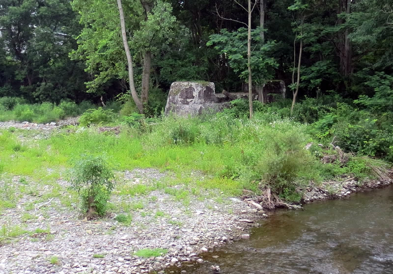
The route I took south was truly off the beaten path as just a few small farms and wonderful old houses scattered the forest landscape. I turned on Ridgeway and snapped this photo of the abandoned DL&W RR ROW as it made its way thru the marshlands in the center of the valley. Using Google's Street View, you can get a nice view of the abandoned ROW in the midst of its surroundings.