Crown Point Iron Company Railroad
Abandoned Hammondville, NY
Did You Know?...
- An Abandoned Town riddled with mine shafts lies forgotten and inaccessible in the Adirondacks?
- A narrow gauge railroad brought ore from the busy Mining Town to the shores of Lake Champlain?
- The top quality of the iron ore from this region was immediately recognized for its purity and strength and received unqualified endorsement from the United States Navy. Crown Point iron became synonymous with excellence and the whole region prospered.
- By the 1870s, Crown Point iron plated the hull of the Civil War battleship Monitor and supported the Brooklyn Bridge.
- By the late 1890s the ore was depleted and the town, its surrounding industry and the railroad were quickly abandoned.
- Today Hammondville is gone, swallowed by nature — another easliy forgotten relic of a diferent era.
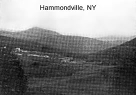
Hammondville, NY
Long abandoned and now no longer even on maps, Hammondville is an intriguing relic of 17th century economics and the industrial side of Adirondack history.
Once an active mining town with close to 50 buildings, Hammondville at its peak had about 700 residents and close to 4,000 people working either in the mines or at Hammondville. Iron ore from these mines was used to build the tracks for its own railroad. Hammondville was built as a company town at the end of a narrow gauge railroad that connected to Crown Point on Lake Champlain. The town was named after Civil War General John Hammond who was the leading citizen of Crown Point and chief organizer of the local iron business.
Now the all the buildings are razed, the tracks long ago removed and the ruins of the once proud town are overgrown by nature. There are no existing structures and the area is pock marked by gaping mine shafts while signs caution against "caving ground”. The land is apparently owned by a local hunter's association and no trespassing signs at the main entrance make it clear that exploration is strictly forbidden.
It is been said that open shafts present an extreme danger for anyone walking off the beaten path. These unmarked shafts extend up to one mile straight down. Under the surface some 14 miles of tunnels are interlaced. These tunnels from time to time collapse and cause some displacement of ground surface.
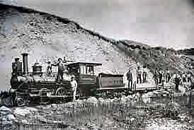
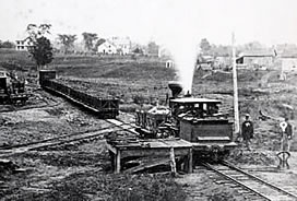
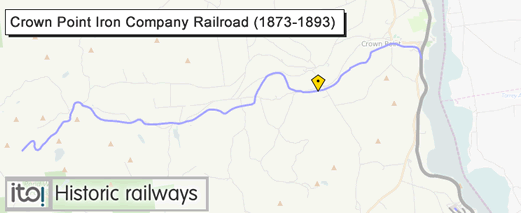
Crown Point Iron Company Railroad - 1873 to 1893
This 3-foot Narrow Gauge was begun in 1872 and completed in 1874. It was built from Crown Point on Lake Champlain and reached 13 miles inland to tap the mines of Hammondville. By 1882 it was reportedly operating with four locomotives, two passenger cars, four boxcars and 110 small ore cars. An extension to Schroon Lake was even considered but never built.
The depression of the 1890s along with the discovery of substantial iron deposits in the Mesabi Range near Lake Superior brought the operation to a close in 1893 and the line was removed in 1896.
Hammondville, NY
The thumbnail images below are a sampling of images sourced from the Adirondack’s Museum's
Advanced Search
Keywords: Hammondville or Crown Point Iron Company
Please visit the site to see and/or purchase full-size images Fair Use Notice
Ironville ca.1890
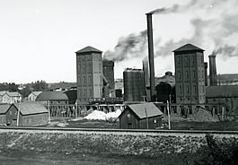
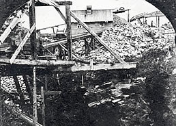
Crown Point Iron Company ’s blast furnace -
Crown Point, NY
Tenements for Irish miners at left
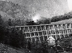
Knob Mountain Trestle
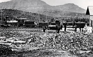
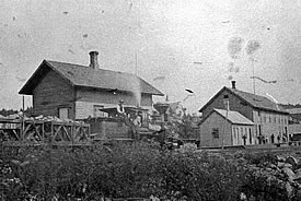
Hammondville Depot and Ore cars
Crown Point Iron Company’s R.R.
crossing the N.Y. & C. R.R.
Entrance to Pit A. Mine No. 1
Hammondville, NY
Hammondville,N.Y
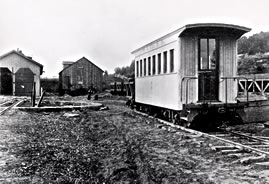
Freight House, Depot and Office
Crown Point Iron Company’s Railroad Engine House
Crown Point, NY
Source Credits and Further Details
Hammondville
- Hammondville - Essex County Ghost Town (PDF) By Connie Pope
A Wonderful year-by-year account of the rise and fall of Hammondville - Hammondville - The Boom Years of Iron
- http://www.knobpond.com/HammondvilleHistory.html
Hammondville History (replete with a PDF map) - http://adirondack.pastperfectonline.com
Hammondville Photo Collection
Crown Point Iron Company Railroad
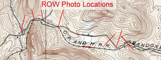
- Abandoned ROW Details
Scroll down to find the Crown Point info - Historical Photos
- Volume Three: Where did the Tracks Go in the Eastern Adirondacks?
Purple Mountain Press - Michael Kudish
Ironville and Crown Point
Retracing the Right of Way
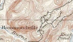
On Sunday, Oct 26th, I ventured—with two friends—via car on the backroads from Paradox Lake towards Ironville to retrace the ROW of the Crown Point Iron Company Railroad. Equipped with an historic topo map we stopped and photographed where the ROW crossed the road.
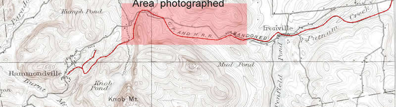
Hammondville - Off Limits
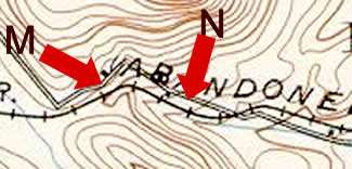
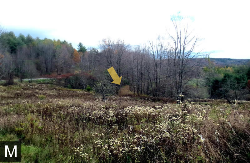
Our plans were to check out Hammondville via the northeast entrance as current maps indicate that a primitive road into former Hammondville intersects at the sharp curve. Google Map View >
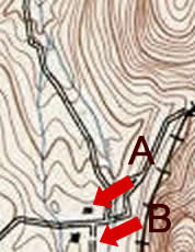
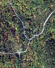
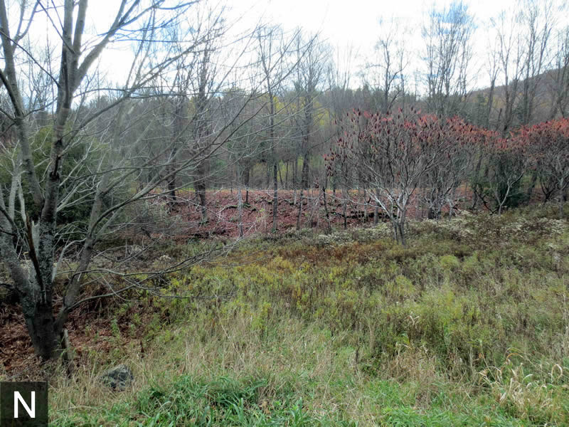
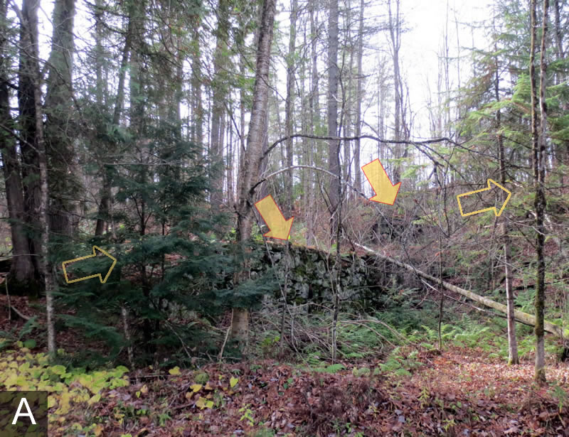
Right before the sharp turn in the road, we discovered a series of foundations. Perhaps—as the historic map suggests—these were either crib walls for the roadway up the Hammondville (arrows) or foundations to buildings.
As tempted as we were to visit the abandoned town and mines, it was strictly forbidden and hunting season as well! We had no intention of becoming a Dick Cheney "Oops" moment...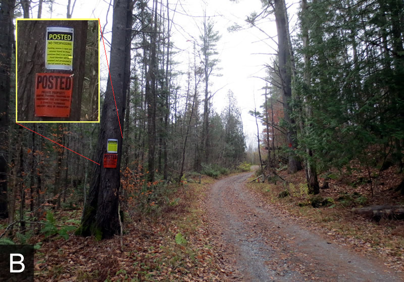
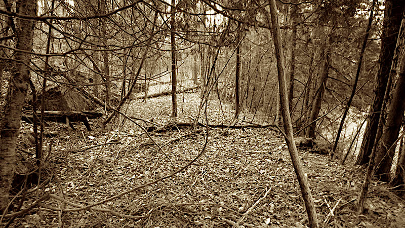
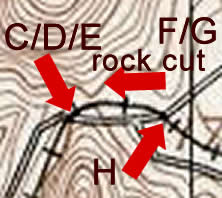
Crossings and Rock Cut
Despite the "No Trespassing" setback, we were amply rewarded with clearly defined views of the ROW at every road crossing we encountered.
Looking south westerly
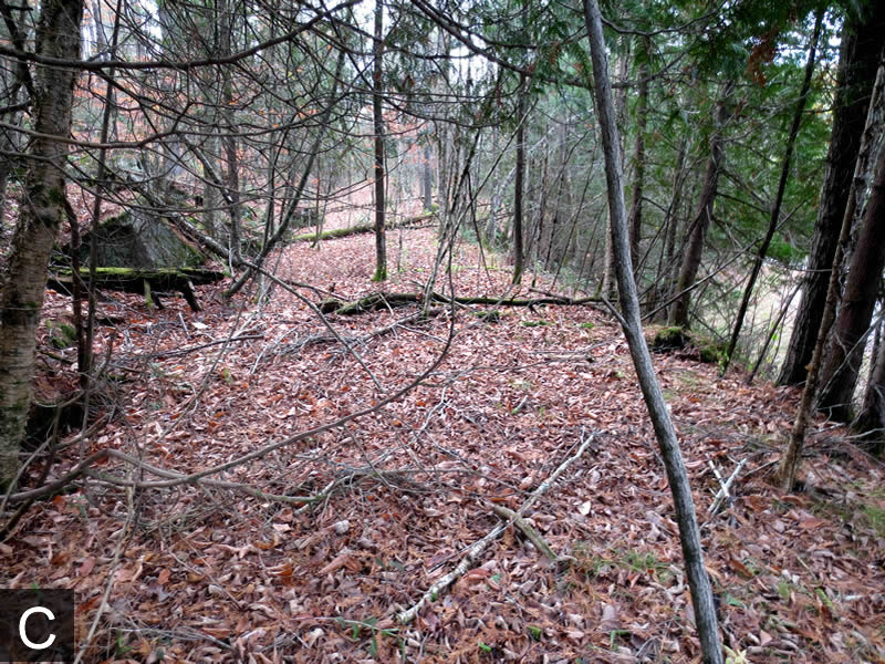
The Northeasterly view
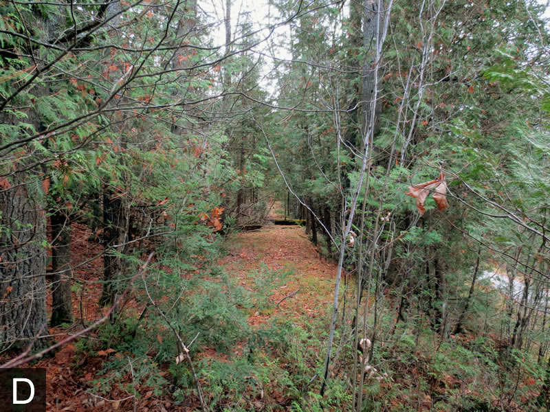
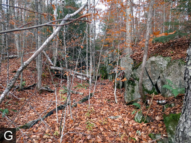
At the next road crossing—off to the side—there was a rock cut (straight ahead in the first photo)
A short walk on the ROW revealed the rock cut - overgrown with trees
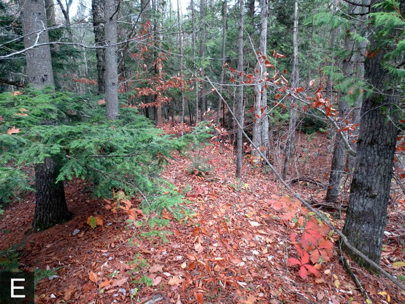
The ROW turned south easterly right after the intersection
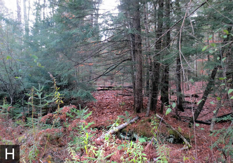
Emerging from the Woods
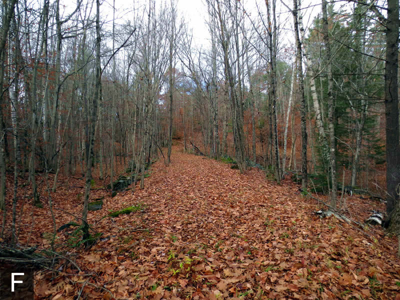
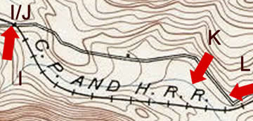
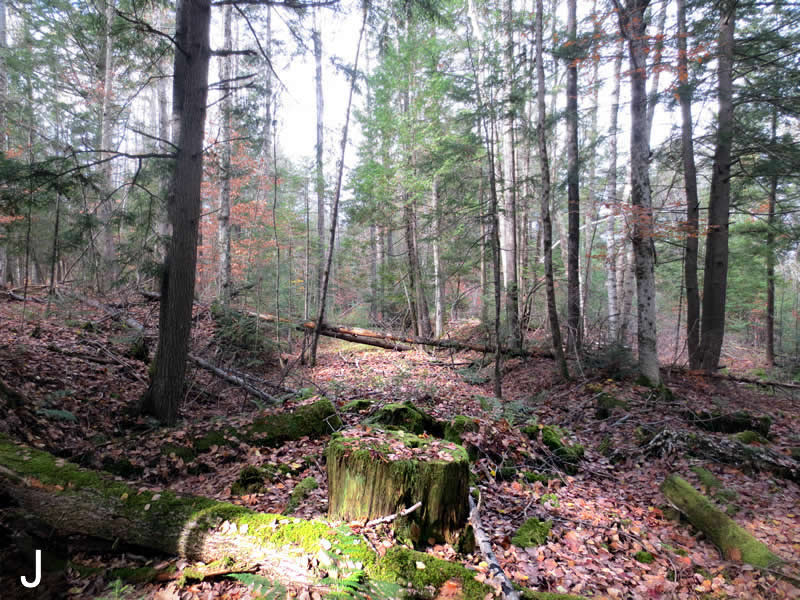
Photos I and J are taken at the next road crossing. Photo J is actually a short walk northwesterly into the woods from the Photo I location.

A little further in
A pond is now between the road and the ROW (not on the historical map)
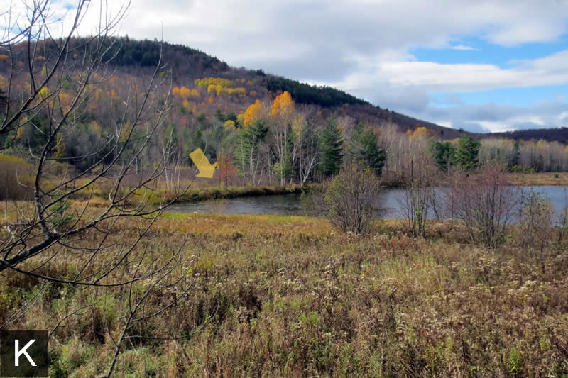
This long private road was the former ROW
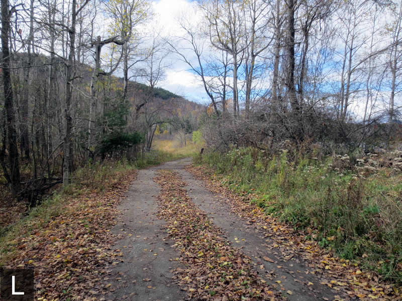
Near Ironville
The ROW paralleled the road further down the hill and glimpses were fleeting but available...
A glimpse of the raised embankment as we neared Ironville